
Welcome, from sunny Australia!
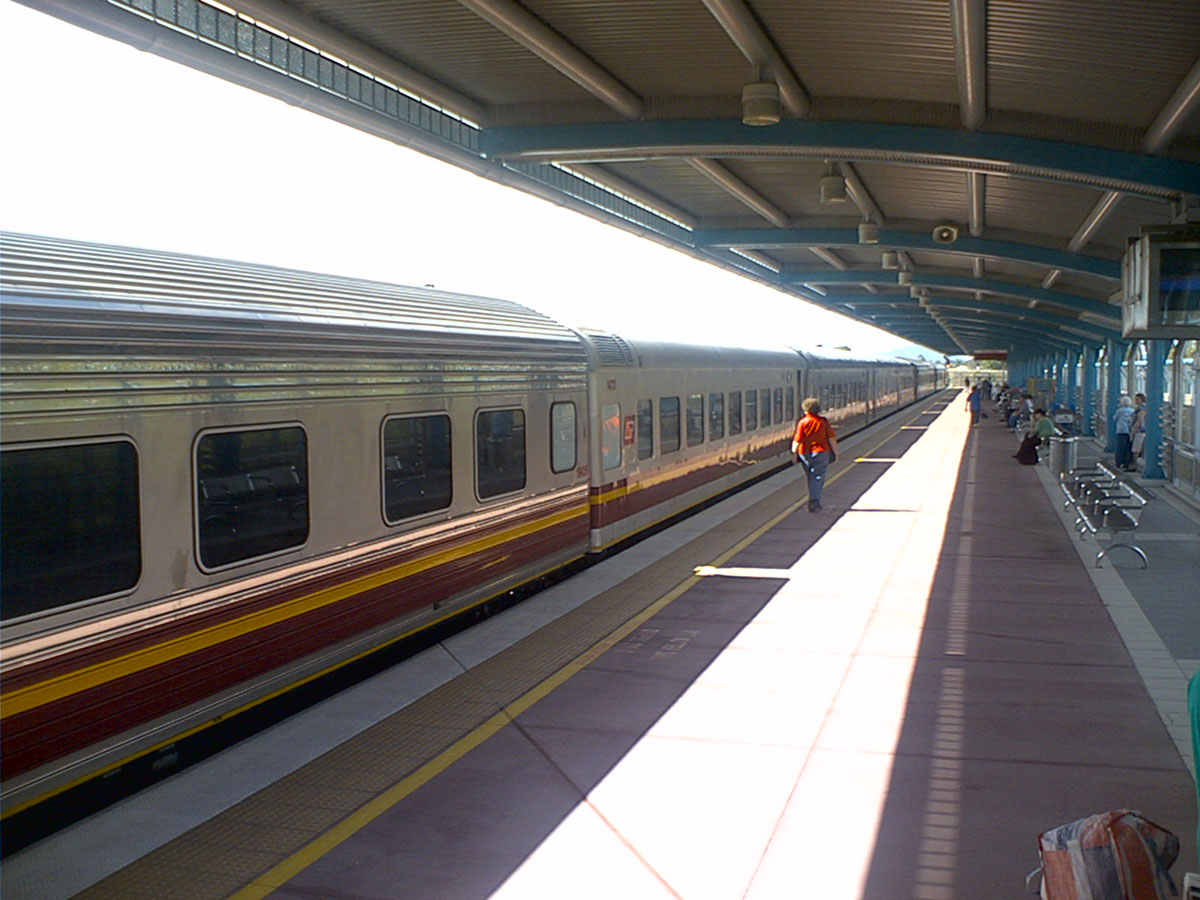 |
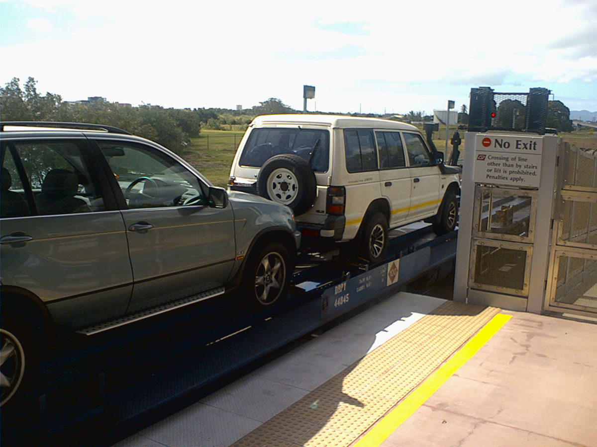
On the morning of the 15th of June 2006 Dad & I took the Pajero up from our home on the Gold Coast to the
Roma St train station, to put it on the Sunlander train to Cairns
later that day. We left at Brisbane at about 1pm and after a 30 hour
trip pulled into Cairns. The cabin on the train wasn't very large, but
fortunately the time passed quickly enough. I had my laptop with me so
we watched a couple of movies, read some books, and slept as best we
could. On the left is the train at the Townsville stop, and on the
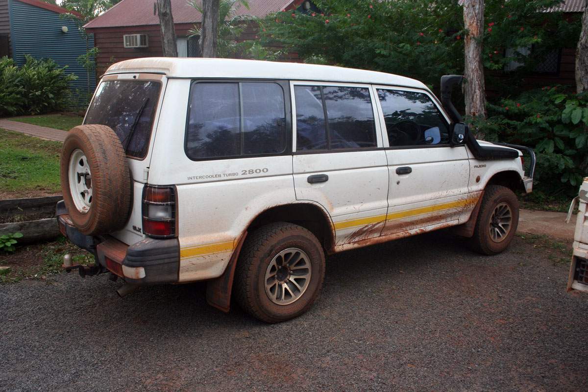
right in Mackay. You can also see the small metal cover Dad made for
the Snorkel on the Pajero, to stop the rain water getting in, but since
the car travelled backwards it wasn't a problem anyway. |
 |
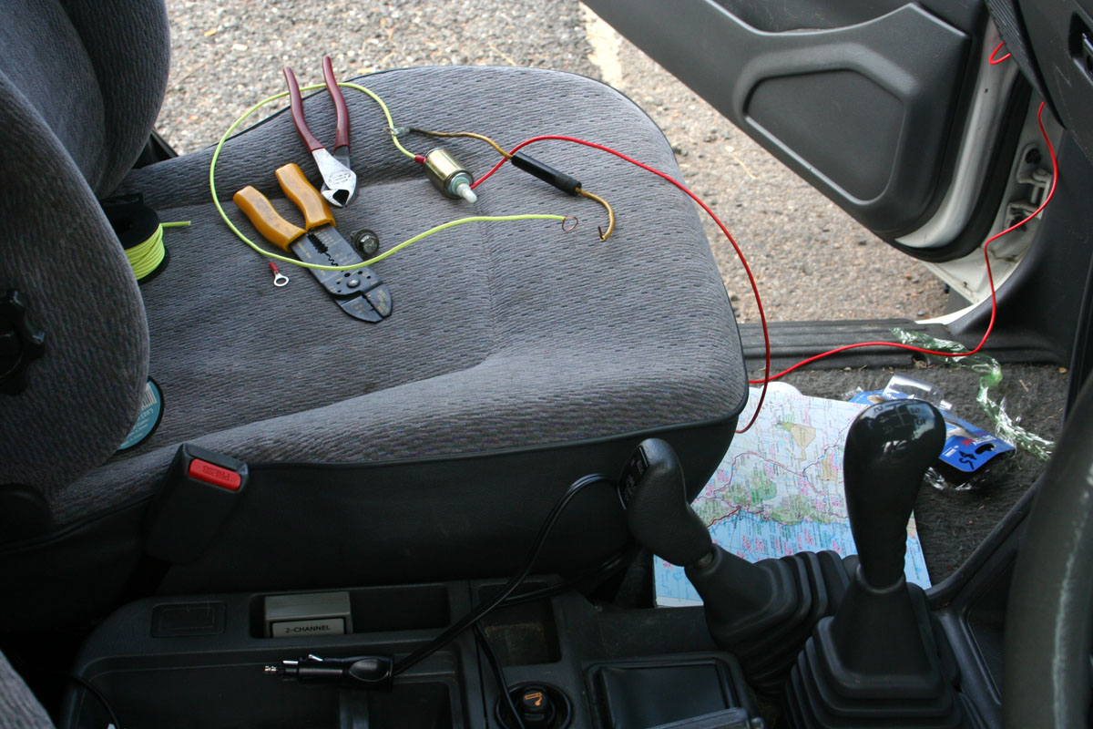 |
We
left Cairns with a troublesome fridge. A visit to the car electrician
on the way out of Cairns revealed that the power plug we were using was
faulty so we bought another one. That didn't work, so in Mareeba we had
to hot-wire the fridge directly to the battery in the car. Despite that
it continued to play up over the next few days, but eventually came
good and gave no further trouble throughout the trek. The good bit was
that
we connected it up to the second battery in the Pajero, which we can
disconnect from the other battery with an isolation switch and so run
the fridge all night
with the engine off and still start the car in the morning. |
 |
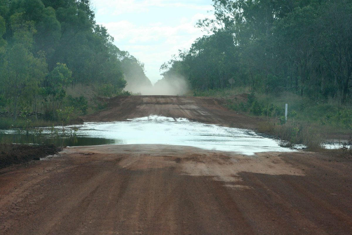 |
The dirt road up to the Weipa turnoff was mostly very good but after that it took a decided turn for the worse overall. There were some serious dips in the road, covered with small streams, and although no big deal for the Pajero there were still one or two one bigger than what we would have liked. These two photos show what a lot of the better parts of the road was like. All bar one of the creek crossing were pretty easy. The one deep one had the water come about halfway up the headlights, and so without the snorkel the engine may have snuffed. We never really needed 4WD anywhere. The first night out of Cairns we spent at Musgrave Roadhouse. The steak dinner was lovely! The road past the Weipa turnoff was far less well maintained and travelled. But still most of it could have been travelled over with a family car. | 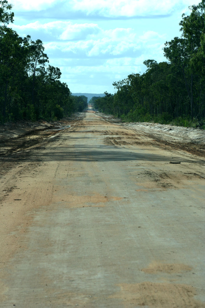 |
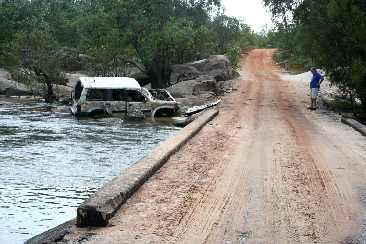 |
We left Musgrave at 5:40am and spent the first couple of hours fighting the dirt track between there and Coen. It's in terrible condition and it took nearly two and a half hours to do only 108km! Some of the other crossings were a little rough as well, for example the Archer River crossing on the left. Only weeks beforehand, the water levels were much higher, and the poor people in the Nissan Patrol obviously thought they could make it across but didn't. No idea what happened to the people sorry. The water level was over the top of the large rock in the middle of the photo when it peaked. On the right is one of the thousands of ant nests we passed on the way. Dad is about 1.87 metres tall so you can see how big they get. We also spotted some collapsed nests, broken clay covering many square metres of ground around the base. | 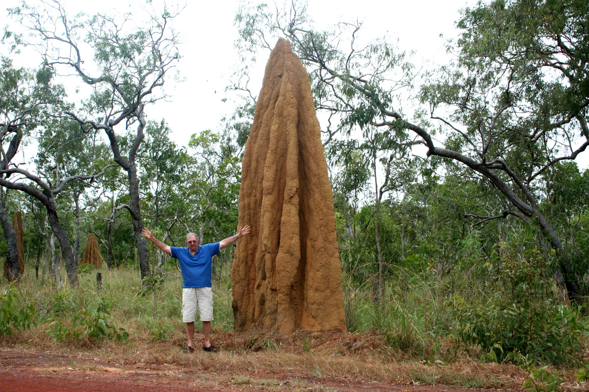 |
 |
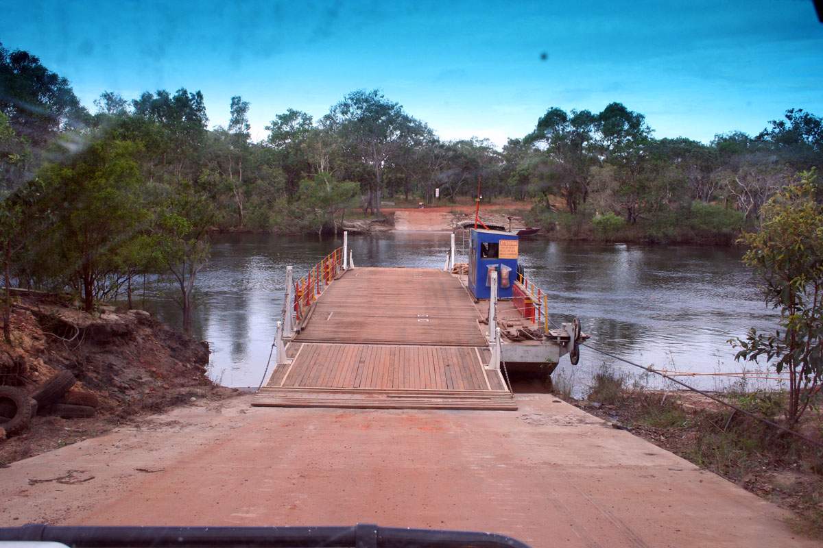
The next problem on the way north was that alcohol isn't allowed into Bamaga so we came up with a plan to hide Dad's bottle of scotch ... We came across a very prominent intersection and looked around to find a distinctive tree – Then stuck the bottle behind the tree for our return a couple of days later. It was a long drive from Musgrave to Bamaga, but it was worth it. About 60km before Bamaga we had to cross the Jardine River. The Jardine River ferry cost $88.00 to go the full 50 metres across the river, but it's the only way to the north. After a ten hour drive we finally pulled up at the hotel in Bamaga and quite rightly put our feet up for the night, on the 18th of June. |
 |
 |
19th of June. |
 |
 |
It was only
about 33km from Bamaga township to the tip, but it took over 90 minutes
to do that because the road was in fairly poor condition. This time we
did need 4WD - On the left is one of the better parts of the road. One
of the other problems was that were no signs as to where to go with the
many intersections we came across. We quizzed the motel owner in Bamaga
over this and she said that they put up new signs at the start of every
year, but the tourists steal them. Some educated guesses managed to get
us to the car park, about two kilometres from the actual tip. We
decided to wak around to the tip on the beach, rather than over the
rocky outcroppng as we were told we could get all the way there on the
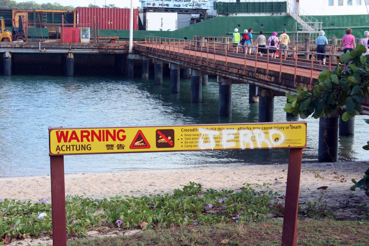
sand. We couldn't .. On the walk over the beach my thongs get very muddy, and I decided to give them a wash in the ocean as there was rocks ahead and I figured I'd need some foot protection. So after a good look around to make sure there were no crocs to be seen, I went ankle-deep into the water to wash the thongs. Then a big gust of wind came along and simply blew my favourite hat clean off, way into the water! It was far enough into the water so that I'd have to rush back to dump my backpack, full of expensive cameras and so on, then dive back into the water to grab the hat. The hat was being blown out into the water too quickly, so I just had to let it go. I stood there for a minute, swearing profusely, watching it go out into the ocean. The warnings of crocodiles were too strong to ignore. I got a couple of photos of it, as you can see on the right, though much to our surprise shortly after that photo was taken the hat just plain disappeared. We don't know why .... croc or shark ... ? Goodbye hat, I shall miss you. |
 |
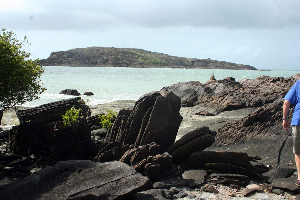 |
The last 500 metres
or so was over some fairly wild rocks, but with Father in tow we slowly
but steadily made our way across them. On the left is our first view of
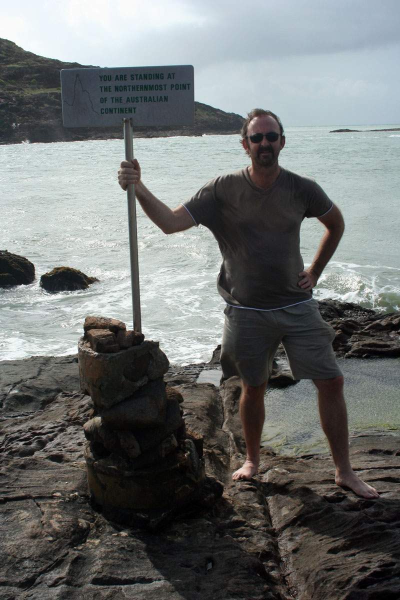
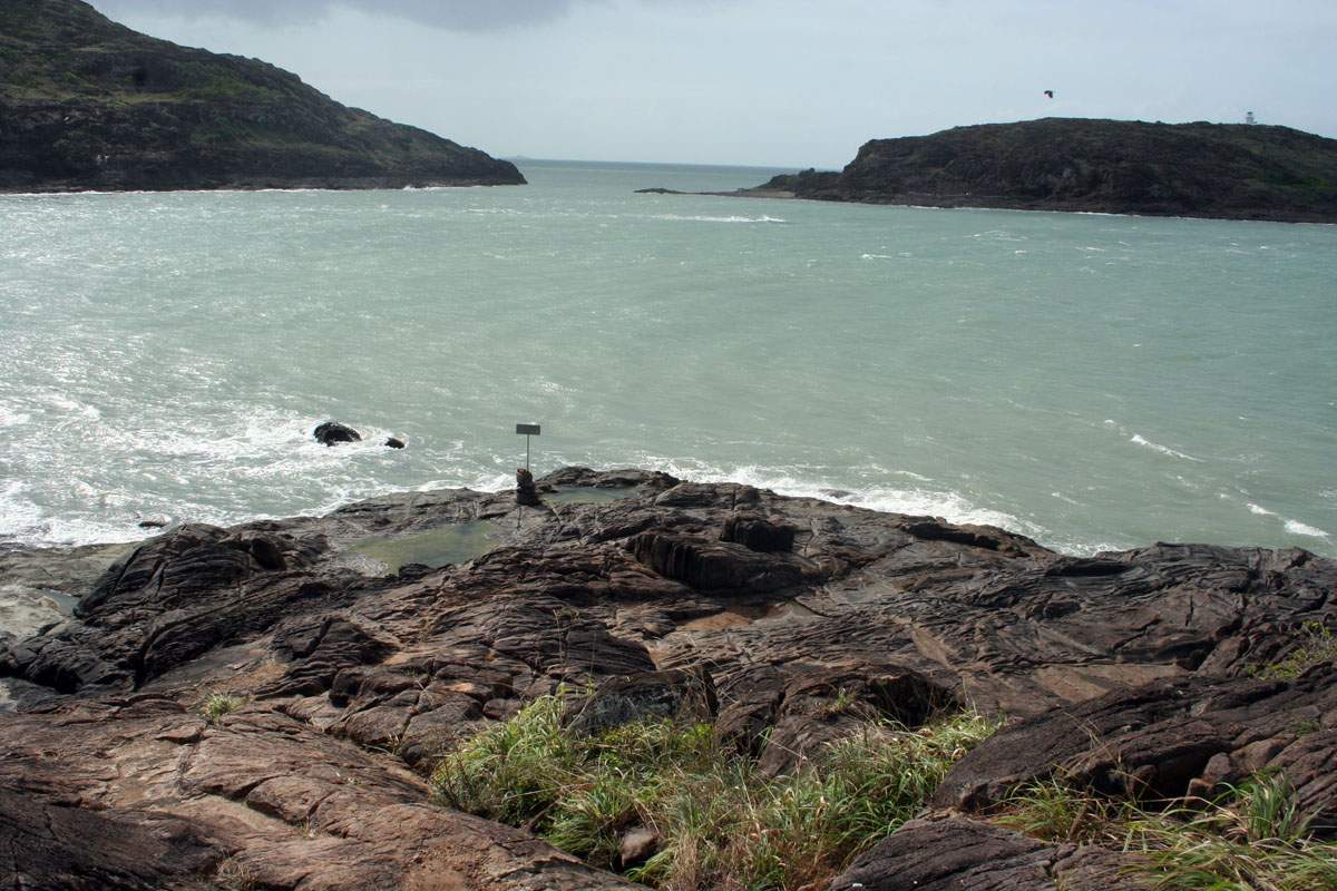
the actual tip itself, and the sign that marks the spot. I ended up
wearing bare feet for the entire walk over the rocks as I got the best
grip that way. So on the right, after a trip of several thousand kilometres, we finally made the northernmost tip. In retrospect, I was pleased that the sign was still there and hadn't been stolen. The day was cloudy and very windy. |
 |
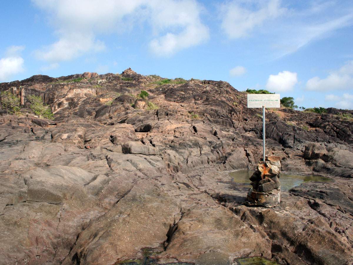 |
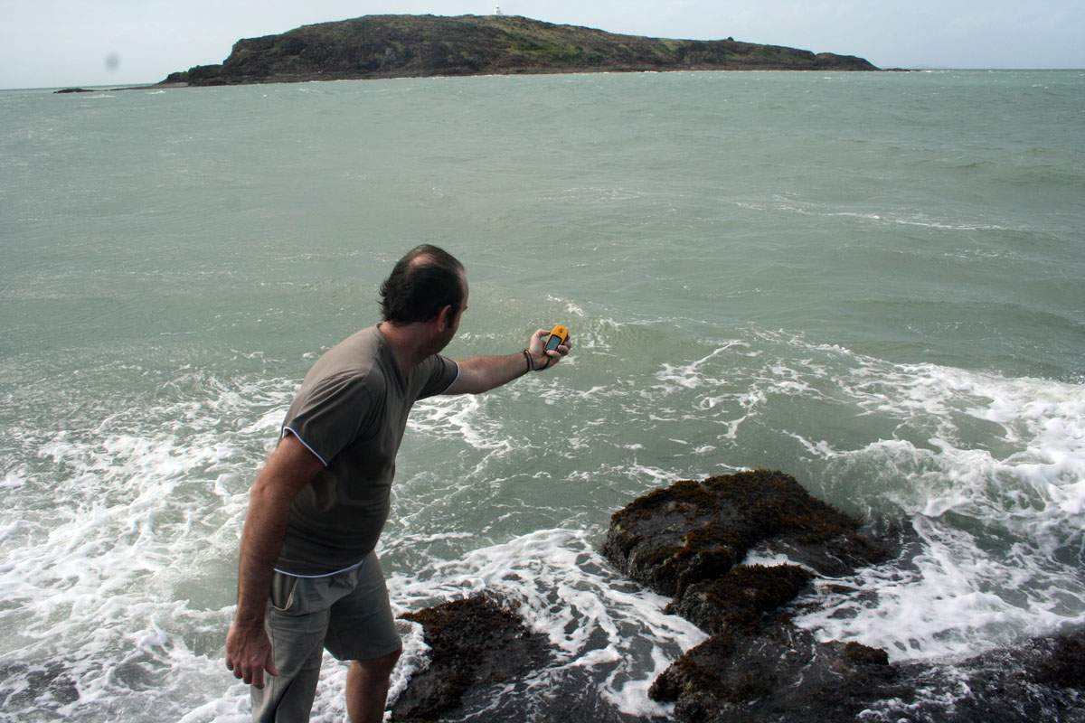
Standing out on
the edge of the rocks, looking back up the hill showed the rocks we'd
have to climb over to get back. If you look up the top of the
hill you can see a rock pyramid that the visitors to the tip have made.
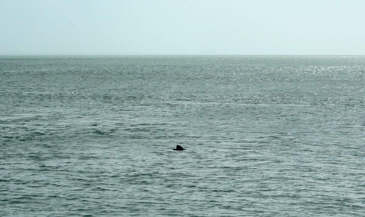
Anyway, it was time to do what I'd come for, and so with low tide happening I climbed out onto the oyster-covered rocks (ouch!) as far as I could, leant out as far as I could, and took a GPS reading - twice, to be sure! The rocks were being washed over by the short, sharp waves, so I couldn't hang around too long. Just like the trek to the southernmost point, if I'd taken a tumble then it would be many hours before I could be rescued. |
 |
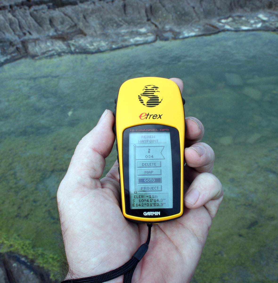 |
So there's the GPS reading I got, the second one was identical. Job done! I've now gone further (probably) on the mainland than anyone else has. Just the westernmost point to go, and I'll have all four done. On the right is the view of the tip from a few metres up the hill. |
 |
 |
We climbed back up to that rock pyramid, and figured that for lack of anything better to do we'd best add to it. So there's Dad doing his daring bit for the day. I had to have a go as well .... It was probably more dangerous than walking out onto the rocks on the tip as they weren't very stable and a few fell down around out feet. But it had to be done, of course! | 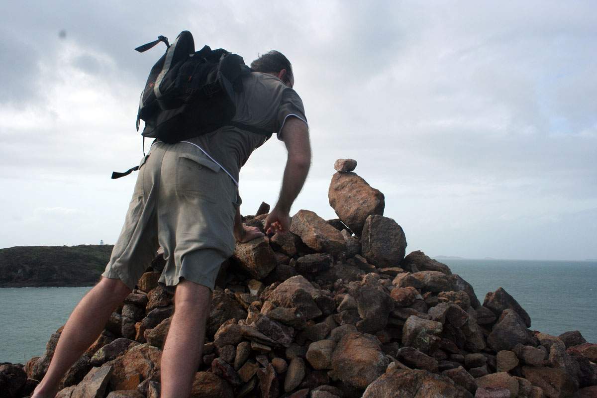 |
 |
There's the
mighty Pajero, on the return from the tip, nicely muddy. The hotel in
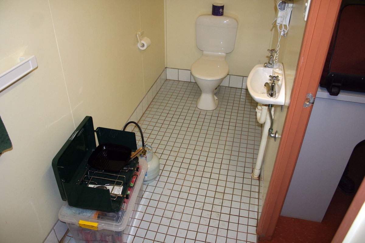
Bamaga was rather expensive - too expensive but there was really not
much other choice - so we decided to celebrate by cooking our dinner
with the small gas cooker we bought in the bathroom of the hotel room.
Burnt sausages and chocolate, yum! That was the only time we used the cooker as well. |
 |
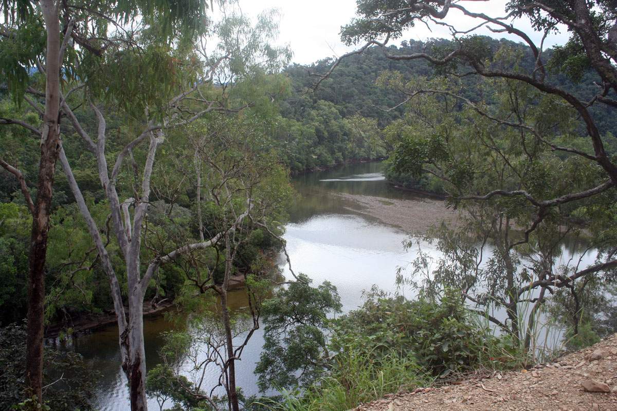 |
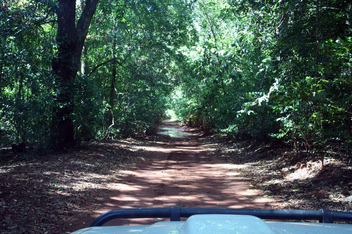
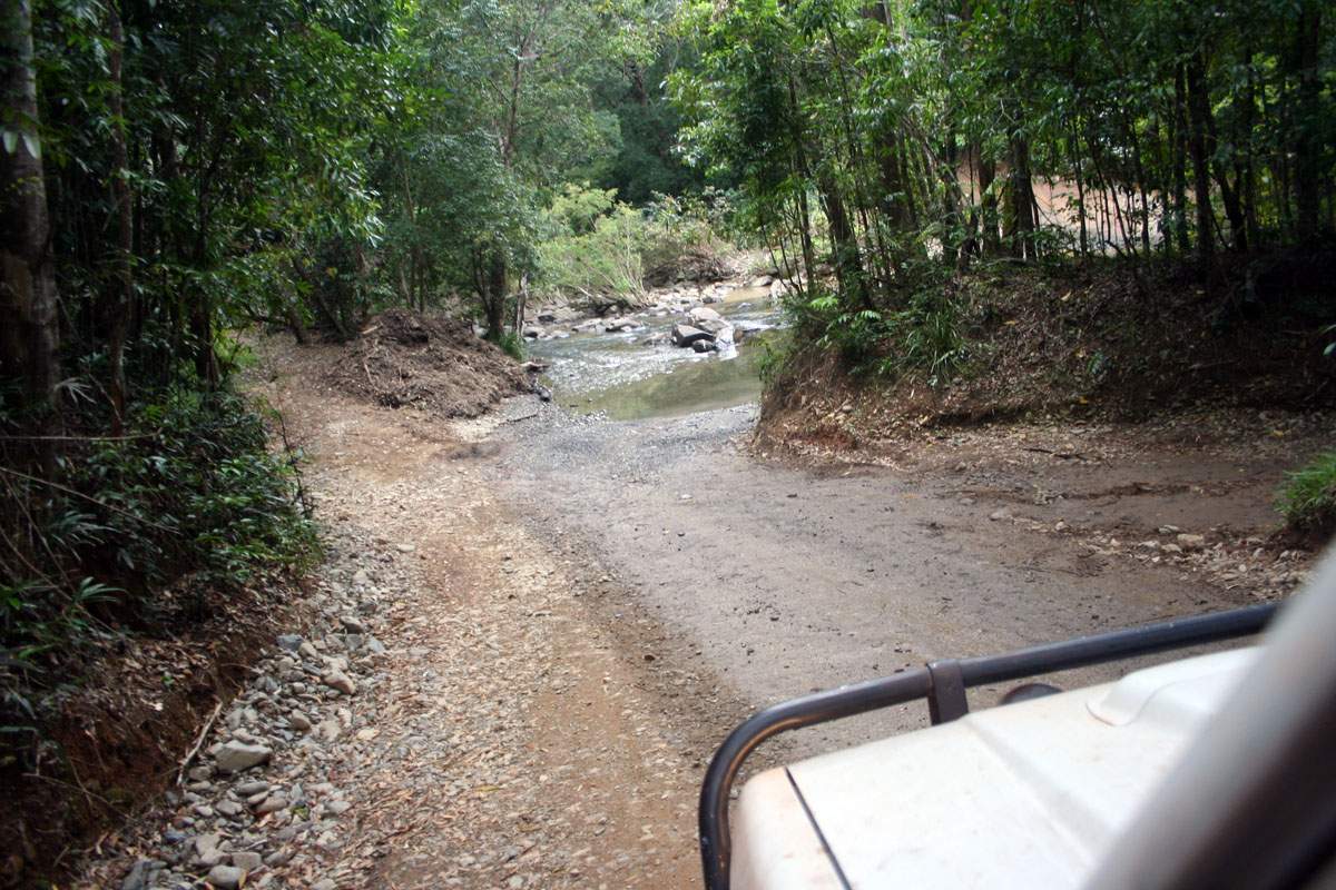
I took a heap of photos of the trip back as well, but the camera played up and I lost the lot. So there's a big gap where we left Bamaga to head south on the 20th of June, then picked up the bottle of scotch at the intersection (Dad's face was priceless!) and a lot of road signs that people had altered to make funny. All gone, sod it. Anyway, we decided to go back to Cairns through Cooktown and then the Daintree rainforest. And these two photos are of our minor trek through the Daintree, with the river on the left and one of the creek crossings on the right. The road was in terrible condition, at least as bad as anything we'd come through in the previous week. It looked like it had been the best part of a year since the road had been worked on. But it was well worth it, as the views were spectacular. I can fully understand why there's so many people fighting to preserve it. |
 |
 |
One of the
crossings was at the bottom of a very long & steep hill, and as you
can see the brakes on the Pajero got hammered. We had to take another
ferry to cross another river but this time it was a lot cheaper than
the Jardine, at a mere $8.00. We stayed in Cairns on the 20th through to the 21st, then on the 22nd drove a few hundred kilometres to Townsville. While in Cairns we took the time to give the Pajero and ourselves a good wash and relax for the day. On the far left of the right-hand photo is the hotel we stayed at, and it was also the same hotel that my Dad stayed at when he worked for Trans Australia Airlines in the 1960's through to the 1980's. It hadn't changed much, and the prices were also much the same. That photo was taken with my mobile phone so it's not so good. The harbour in the photo is where we left from the next day on the ferry to go to Magnetic Island. |
 |
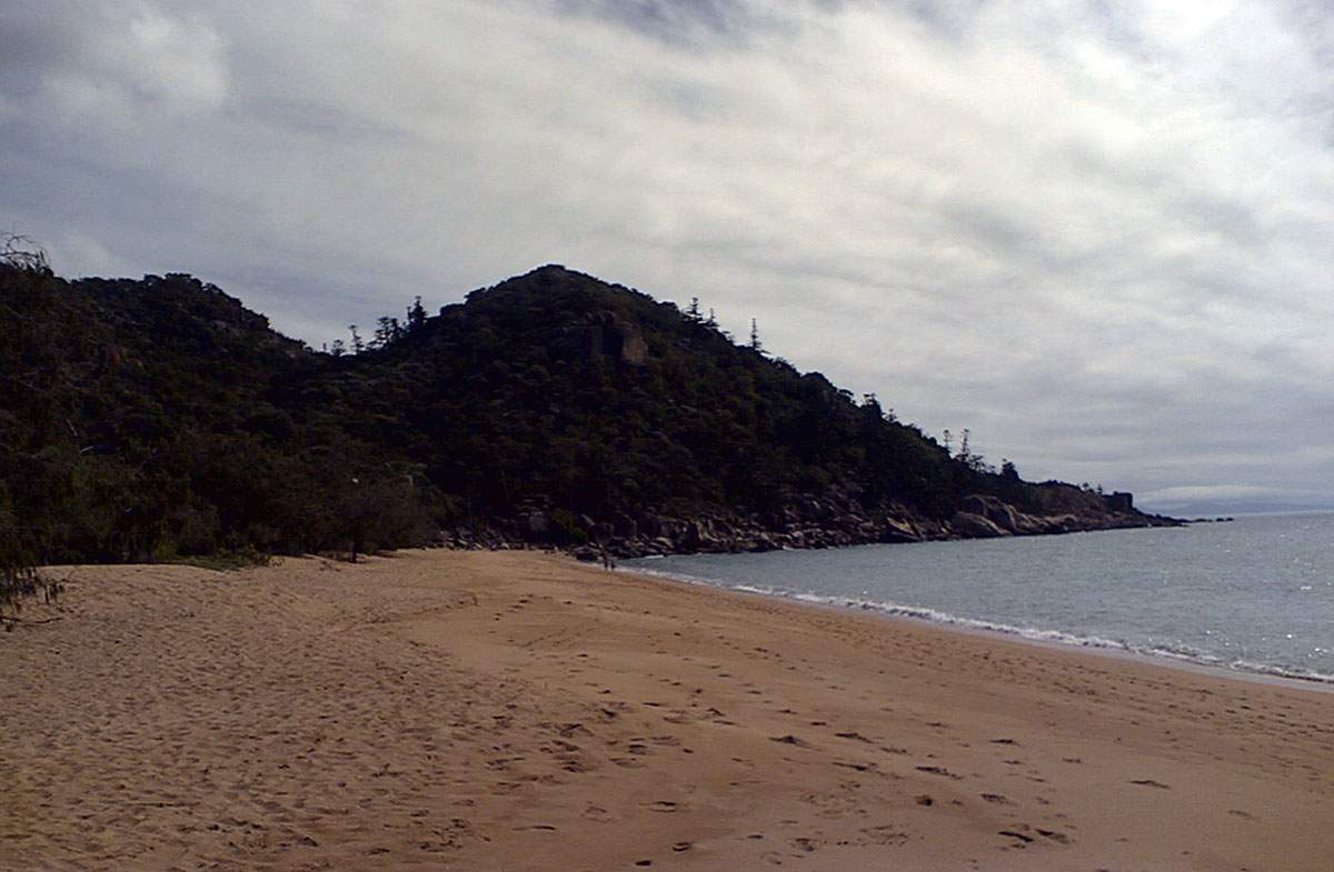 |
Here's another
camera phone photo of one of the beaches on Magnetic Island. It's a
beautiful place, but is rapidly being over-run by tourists. Yes, of
which I'd have to include us as well. We rented a Moke for the day and
had a good drive around. Later that night we went to the local drag
racing strip to watch the street cars and bikes run down the quarter
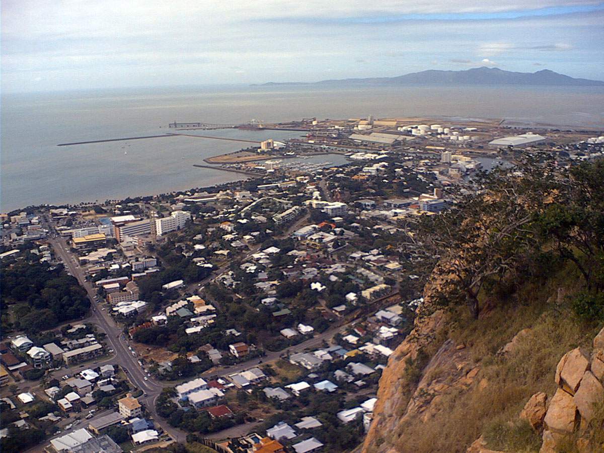
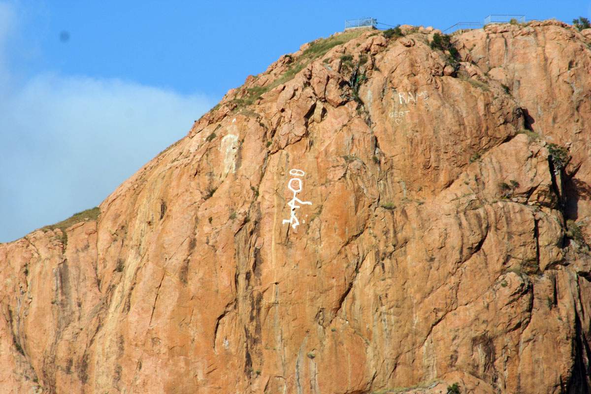
mile. As we left Townsville on the next day I took another photo of Castle Hill. In the 1960's the TV show "The Saint" was popular and some uni students took it upon themselves to paint The Saint sign on the side of the hill. And there it's stayed for decades afterwards. Looks like it's been touched-up a bit recently though. |
 |
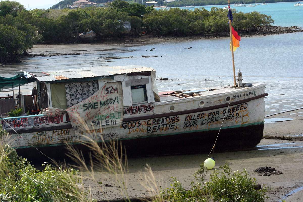 |
On the 25th of
June we had planned to stay at Mackay for the night but we ended up
keeping going and passed through Airlie Beach and Shute Harbour as
well, on the way to Rockhampton for the night. The hippie crowd was
alive and well in those two places. An elequent outburst was painted on
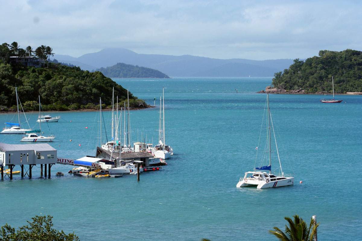
the side of one beached boat, as you can see on the photo on the left. Shute Harbour is postcard beautiful, as you can see on the right. |
 |
Page & contents where applicable © Bill Sherwood