
Welcome, from sunny Australia!
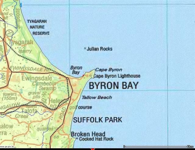 |
The most easterly
point on the mainland is Byron Bay, New South Wales. It's a beautiful area of Australia, frequented by backpackers and tourists - And the occasional tall person with too much time on his hands. |
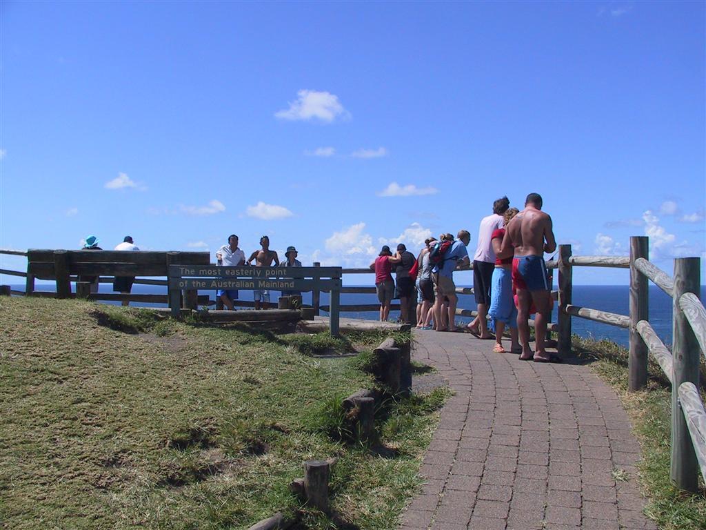 |
On the left is the offical 'Most
easterly point in Australia', so when I first when to Byron that's the
place I naturally went to. Just to go that little bit further, I hopped
over the fence and carefully went out to the edge of the cliff, then
held the GPS out and got a position. Just having a look around, I noticed down on the beach an outcropping of rocks that seemed to be a bit further east than where I was standing. |
 |
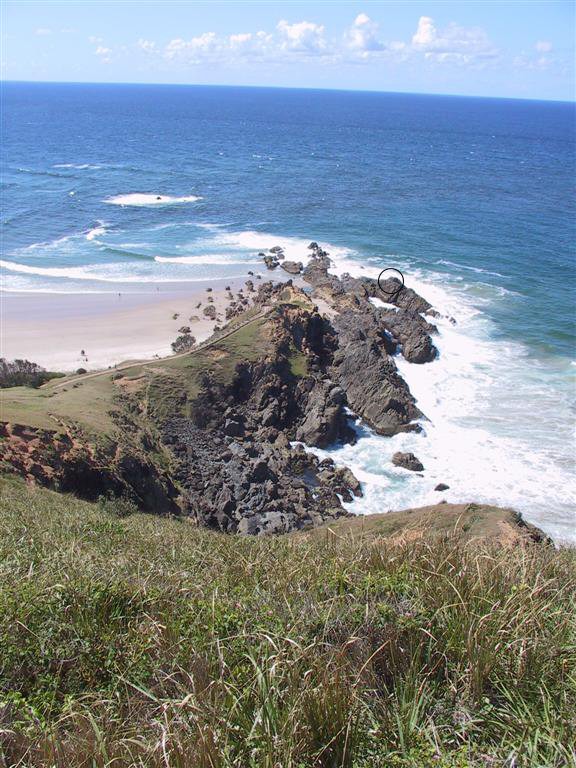 |
So down there I
went, and on the left you can see that point as viewed from about
halfway down the track to it. Circled is the point at which I stood in
the photo below. On the right you can see the view of the offical point
on the top of the hill, as viewed from the beach. I reckon when I can find a day where the waves are very flat, I should be able to crawl around on the rocks at the base of the cliff and get a little further east again - But for now .... |
 |
 |
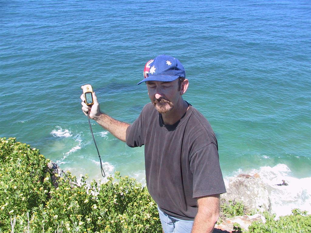
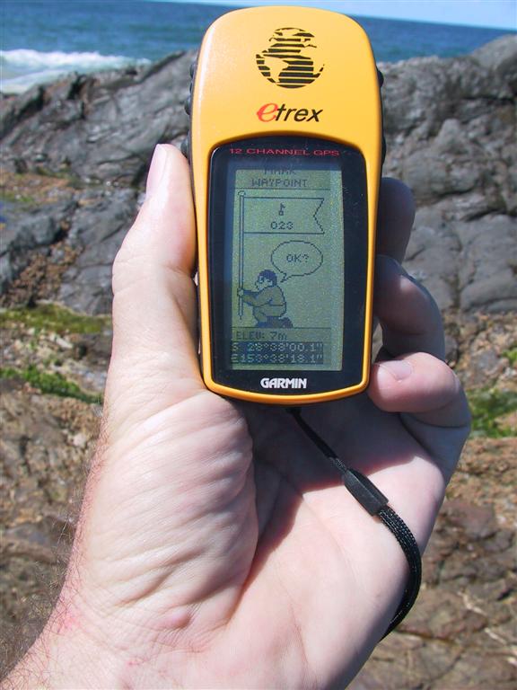
... this is me
standing on that outcropping of rocks. I went out to the edge, held the
GPS out, and clicked the hold button. When I checked the position I found that I went about three metres further east than the offical point, so that's a good start. I've been further east in Australia than just about anyone ! |
 |
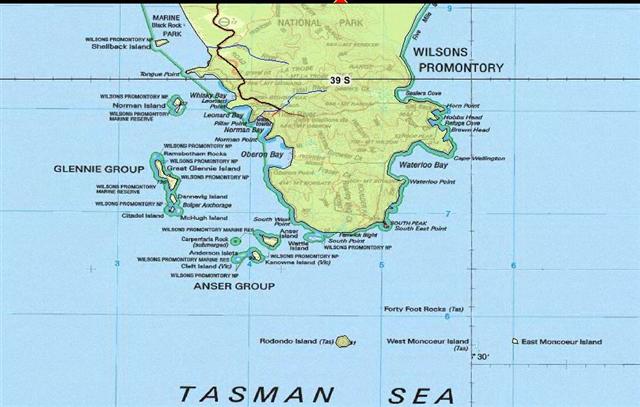 |
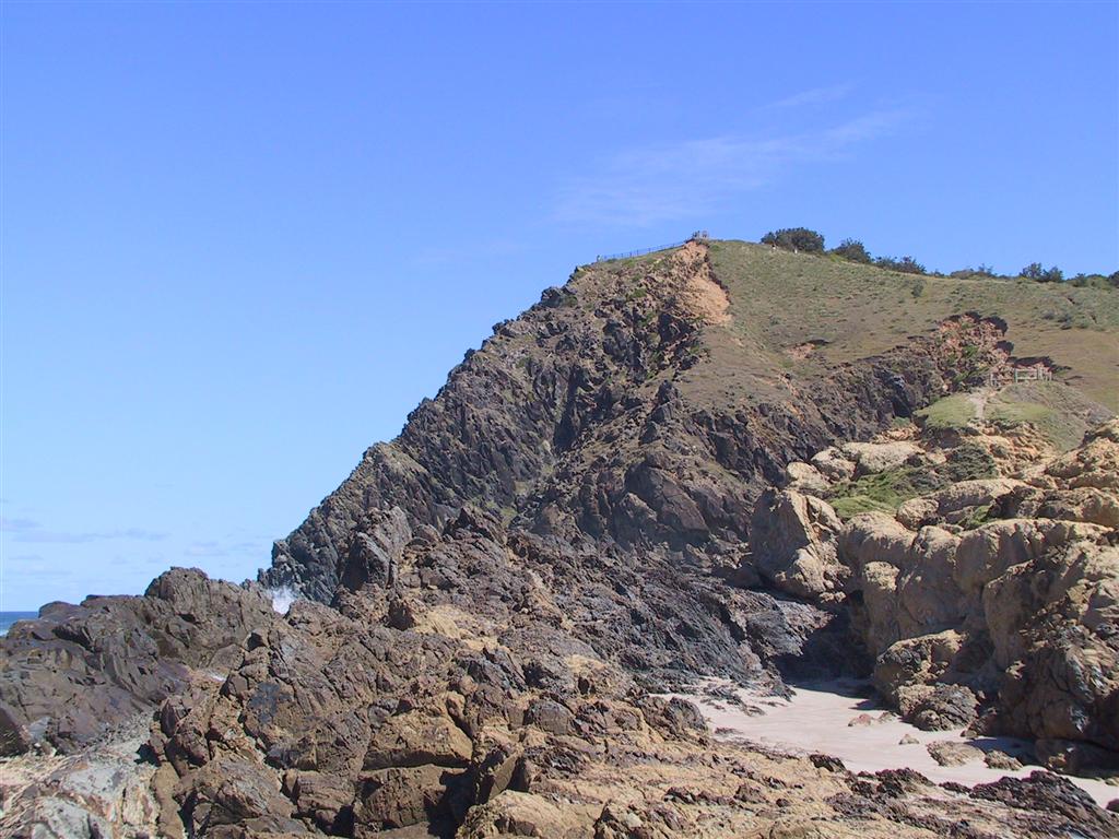
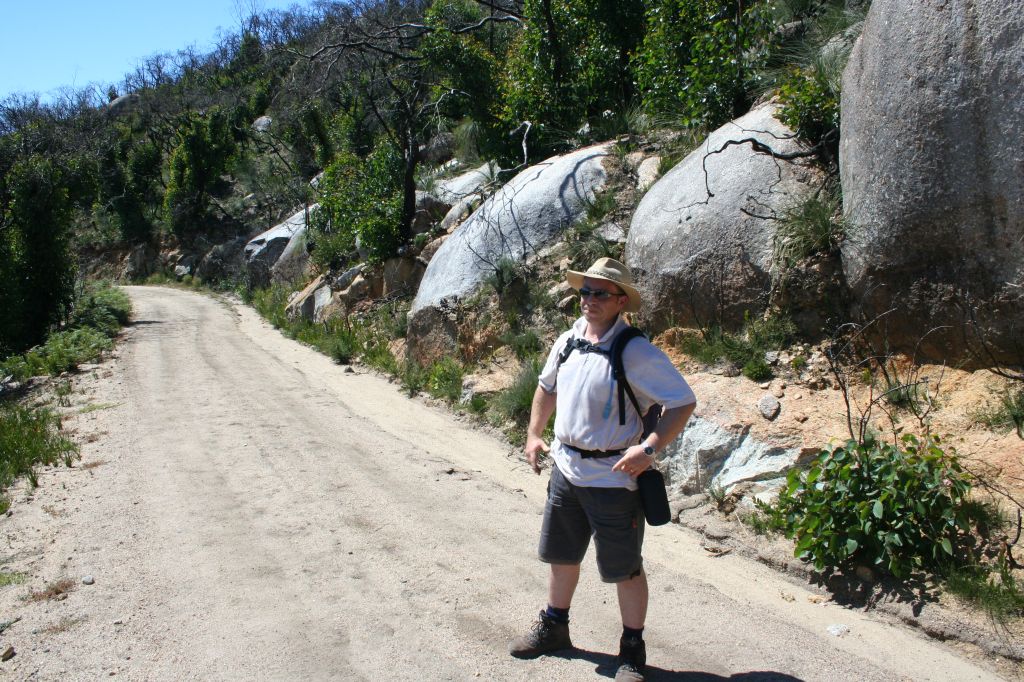
"Wilsons Promontory
is the most southerly point, and it's pretty rocky so it may be hard to
go as far south as I'd like. Getting there isn't too hard, though
there's going to be a fair bit of walking for the last few kilometres." That's what I wrote when I made this page, and it really did look that easy at that point. Little did I know that 'the last few kilometres' would be more like a marathon! I travelled with a good friend of mine, Dave, starting from his place which as a couple of hundred kilometres away on the Mornington Peninsula. We figured it'd take about two and a half hours to drive to the Promontory, then about six hours to walk the 30 kilometres from the car park there to the southern tip - South Point - and back, so a total of maybe twelve hours or so. Well, we got a little lost on the way down and it took closer to four hours, then the walk over the rough terrain simply took a lot longer that what we thought. A grand total of walking for about thirteen hours! The reason for that is the first and last eleven kilometres wasn't too bad, mostly a vehicle track but quite hilly. The four kilometres odd to & from South Point, however, was just a ratty old overgrown walking track over very rough terrain. I thought I could do that distance over that terrain because I am reasobably fit .... and I was wrong. Dave and I got to the tip and I really wasn't sure if I could make it back to the car park or not. But I was very determined and so we just kept on plugging away bit by bit until it was done. We got back to where the park bus had dropped us off (we couldn't park the car where the track started) at about 11pm, but since the last bus left over four hours before that we had to walk an additional three kilometres to get to the car park where we left Dave's car. That took nearly another two hours because I was pretty much The Walking Dead, shambling along. It got to the point where I decided that I'd better not sit-down anymore to have a break, as I didn't think I could get up again. |
 |
On
the left is my travelling partner, Dave. He's a very experienced bush
walker and also a member of the local State Emergency Service, and so
was also able to assist with some battery-powered LED head-lights. I
didn't think we'd need them, but as it turned out the walk took so long
that we used them for hours on the last half of the return leg. On the right is the last few hundred metres of the trek to South Point, and it consisted of boulders the size of houses and everything smaller. Dave and I both do a little indoor climbing and it came in very handy to get across the boulders. It was pretty hard work. |
 |
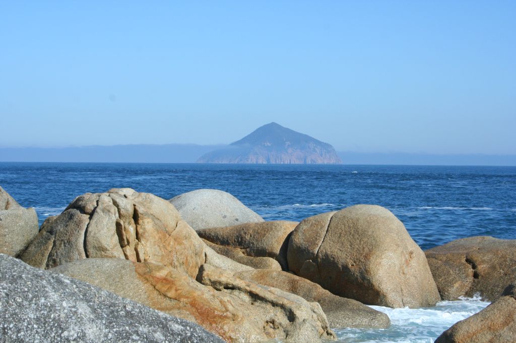 |
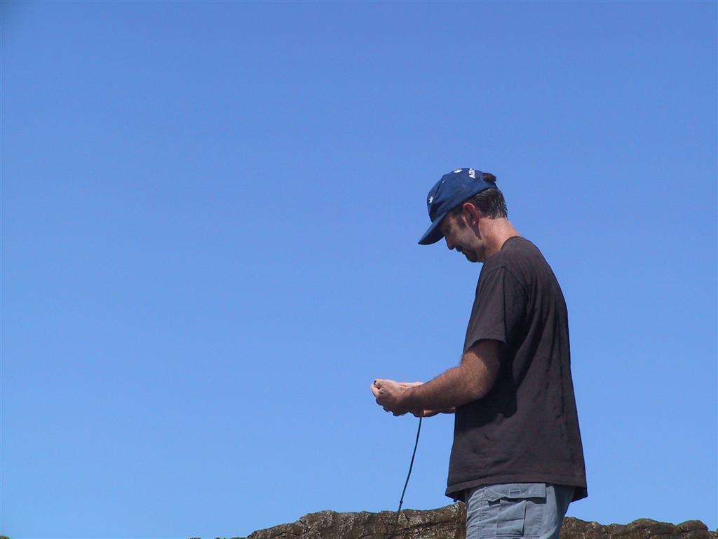
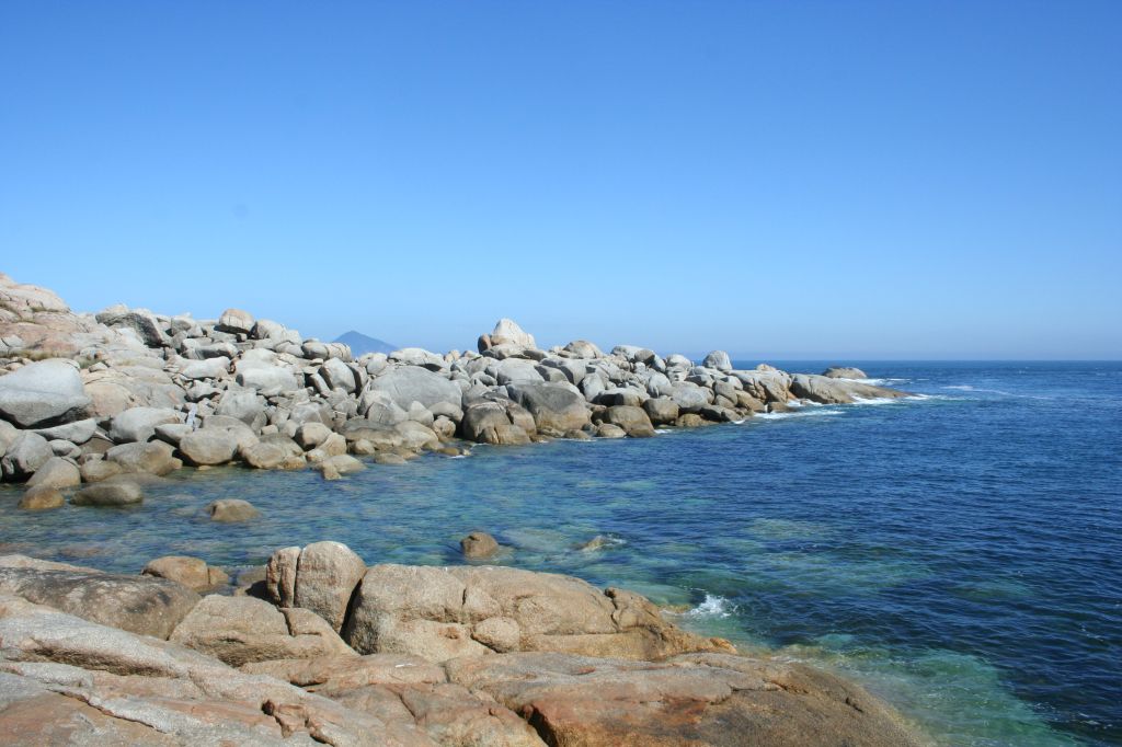
On
the left is the view from the southernmost point of the Australian
mainland. The small outcropping of rocks in the middle of the photo is
actually detached from the main area of rocks, so isn't really part of
the mainland as such. The conical island surrounded by fog in the
distance is Rodondo Island. And finally on the right, after a bloody hard walk is me standing as far south as I could get. Again the rocks behind me have a section of water between them and the mainland, so not part of it. I leant out as far as I could .... |
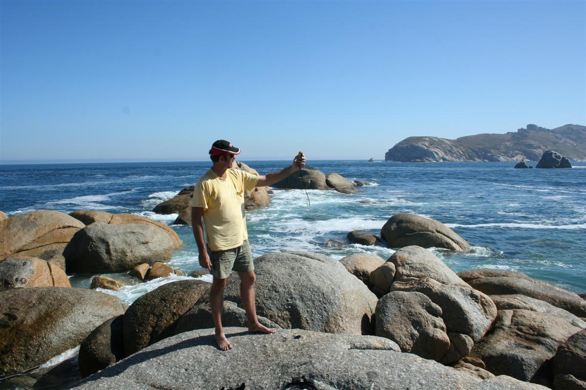 |
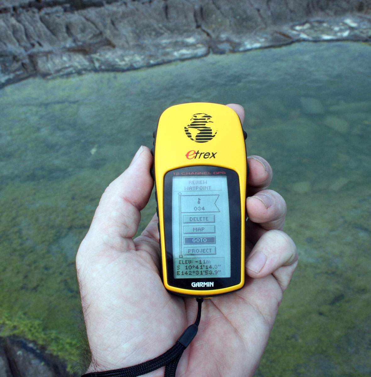
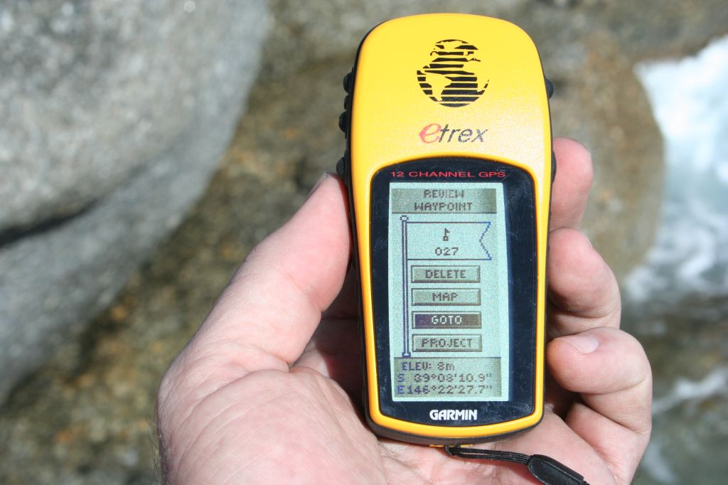 |
... and got the GPS position you can see here. That was at about 4:15pm on the 4th of March. On the walk back my leg joints progressively got more and more painful, but we had to keep going so we did, until it was done. |
 |
"The tip of Cape
York in Far North Queensland is the most northerly point. This again is
hard to reach, as the roads up to Cairns and a bit beyond are good,
but are rough dirt after that. So it's again 4WD territory, and once I
get there the main danger is crocodiles in the water, so I have to be
quick. My Dad and I have a trip planned to get there in our Pajero 4WD in mid-June, 2006. We'll be putting the 4WD and ourselves on the train from Brisbane to Cairns, then driving the rest of the way up & back." That's what I wrote months ago, and much to my surprise it all went pretty much to plan .... for a change! We got the Pajero onto the train from Brisbane to Cairns no problems, then drove it about 900km on dirt roads up to the tip of Cape York then back again to Cairns. Then nearly another week getting back to home. The main casualty was my favourite hat, which got blown off into the crocodile-infested waters. So here's the brief rundown on how we did it .... (and here's the full story, every day of the twelve days we were away, including many more photos) |
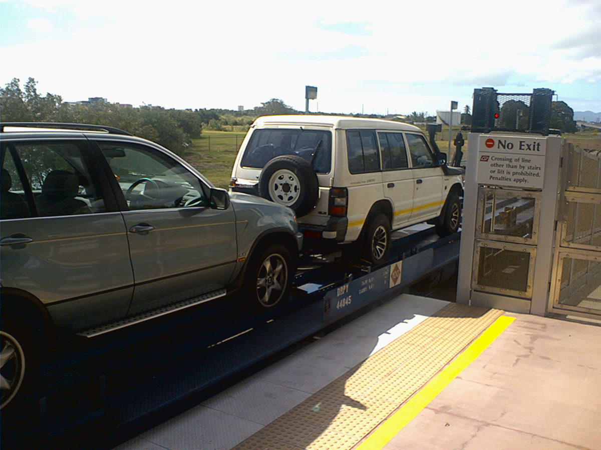 |
On the left is the
Pajero sitting on the train, around Townsville I think. Dad made up a
little metal box to cover the snorkel from rain getting in, but as it
turned out the car was on the carriage backwards so it wasn't really a
problem anyway. The car was full of a heap of gear that we thought we
might need - winching gear, sleeping bags, tarpaulines, etc. Turned out
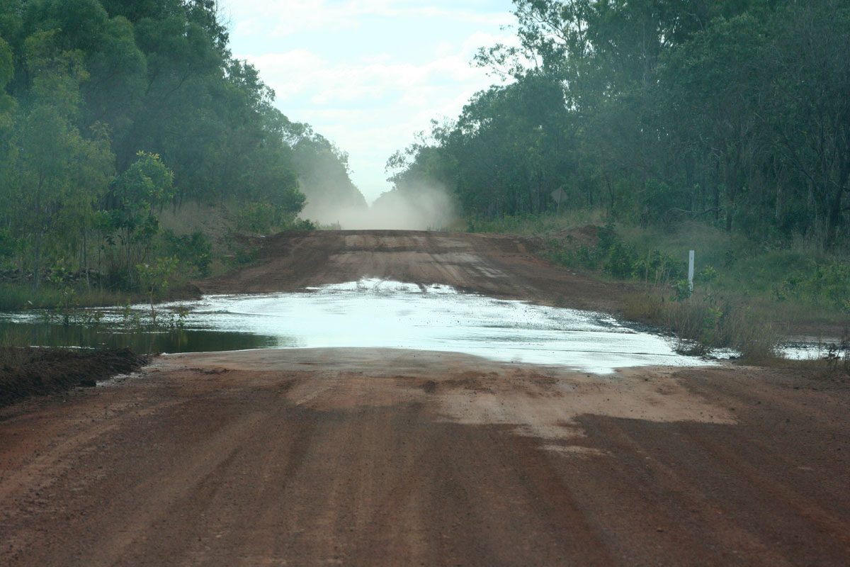
we needed almost none of it. On the right is a typical dirt road that we drove nearly 2,000km on, and one of the many creek crossing we had to do. Fortunately all bar one were not very deep so that turned out to be very easy as well. But only a couple of weeks before, the creeks were metres deeper, and hence unpassable by cars like ours. |
 |
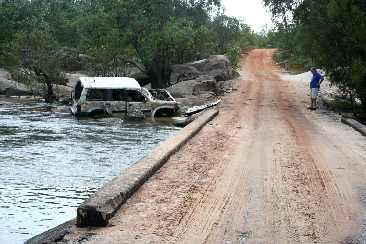 |
Speaking of
unpassable ... The Nissan Patrol on the left didn't make it
across this creek. Not sure of the details but they apparently got
swept off and the wreck was eventually dragged back to the edge of the
crossing by a winch. No idea what happened to the passengers. My Father
inspects the wreck from the other side of the crossing. About a month
or so before, the water level was up over the top of that big rock near
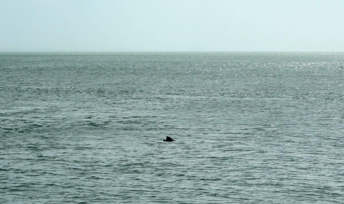
the middle of the photo. Finally up at the tip, and we walked along the beach to get the northernmost part, and my thongs got all muddy so I carefully looked around to see any traces of crocodiles - there were none - so I went to the edge of the ocean to wash the mud off. While I was bending over, a big gust of wind pulled my fave hat off and blew it into the ocean! To get it, I would have very quickly have to have ditch my backpack with cameras & other expensive gear in it, then run back into the ocean and dive in to save my hat. I had very little time to act, and I decided that since the locals were very serious about the croc threat I would have to let the hat go. Shortly after that photo was taken, the hat just disappeared from view, we had no idea where it went so quickly. Croc, shark ... ? Who knows. |
 |
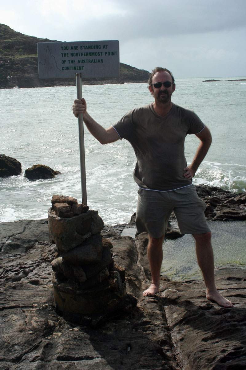 |
There's the
official northermost sign on the left, and me, still annoyed at the
loss of my fave hat. It was a cloudy and windy day, with small but
rough waves beating against the rocky shore. Behind me is a small
outcropping, and there were a few small, flat rocks covered in oysters
that I stood on to go as far north as I could. Low tide was within a
few minutes of when I stood there at about 2:15pm So on the right I carefully went out on the rocks in bare feet for the best grip and held the GPS out as far as I could. The rocks you can see in that photo were mostly covered in short, sharp waves. so not safe enough to stand on. Like the sourthernmost point trip, if I'd gotten into trouble it would have taken many hours to get help. |
 |
 |
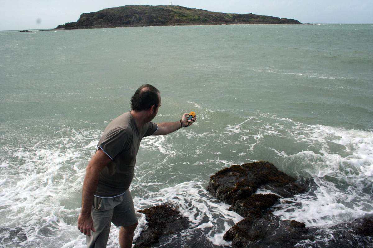
And there's the position I got. I did it twice to make sure and got the same position twice. Job done! On the right is my Dad putting a small rock on the top of a pile of other rocks that visitors to the tip all seem to make. That wasn't the only pyramid of rocks, there was maybe ten more but that was the biggest. |
 |
 |
Steep Point in Shark Bay in
Western Australia is the most western point. I plan to get there by flying to Perth, then up to Geraldton, then hiring a 4WD and driving the rest of the way. There's just a tall cliff at that point so it may be difficult to go as far west as what I would like. |